Kulkyne Way Landcare Group
Description
 |
 |
 |
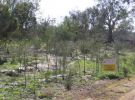
Kulkyne Way Landcare Group was established in 2002. We conduct revegetation and weed control on public and private land. We also provide natural resource management information to the broader community and education activities through partnerships with our local primary school and kindergarten. We actively support our local community by purchasing locally and sponsoring community activities. We have 40 members.
The Kulkyne Way Landcare Group area comprises about 500 km² and follows the Murray River corridor from Red Cliffs to (and including) Hattah Kulkyne National Park. The Calder Highway is the western boundary.
Junior Landcare too! Linking with Nangiloc / Colignan and District Primary School and Nangiloc and District Kindergarten.

Download our membership form here
View our latest newsletters here.
We are always looking for volunteers. Call Fiona 50291404
Kulkyne Way Landcare Group is a member of the Northern Mallee Network. Residents of the Karadoc, Iraak, Nangiloc, and Colignan communities formed the Kulkyne Way Landcare Group (KW LcG) in June 2002.

The group was named after the main road that traverses the landcare area to indicate the intention to include all localities equally in landcare activities. Kulkyne Way is a horticultural landcare group concerned predominantly with horticultural land, some dryland farming, and river reserve crown land along the whole northern boundary of the Kulkyne Way landcare area.
The Kulkyne Way Landcare Group area comprises about 500 km² and is located south east of Mildura between Karadoc and Hattah-Kulkyne National Park. The eastern boundary is the winding Murray River with its floodplain, which is largely crown land. The width of the crown land varies from the minimum 60 m to several kilometres. The Calder Highway constitutes the western boundary.
Approximately 1100 people live in the Karadoc to Colignan region as permanent residents.